The Site Of A School In 2004 And Plans For Change | IELTS Academic Report Sample
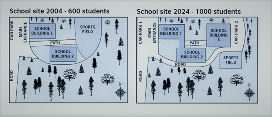
The diagrams below show the site of a school in 2004 and the plan for changes to the school site in 2024. Summarise the information by selecting and reporting the main features, and make comparisons where relevant.
Here is a band 8 IELTS report on this topic written by one of our students. Need help with IELTS writing? Get your IELTS essays, letters and reports corrected by me.
Band 8 IELTS report sample
The first map illustrates the school site in the year 2004. The second map shows how the school site will look in 2024 after undergoing the proposed developments. Overall, a comparison of the two maps shows that the school site will undergo significant changes by 2024. This development will increase the capacity of the school from 600 students in 2004 to 1000 students in 2024. As the first map shows, in 2004, there were 2 school buildings, a sports field and 1 car park. A path ran from the main entrance to the sports field between the 2 school buildings. As per the proposed plan, a third school building will be added in the place of the sports field and there will be a car park on its east. The new road will be laid to connect the main entrance to the second car park which will be located on the east of the third school building. The sports field will be moved from its current location to south-east of the second school building in the wood land space to make room for the third school building. The redevelopment plan also proposes to internally connect the first two buildings. All in all, the new development will cause the woodland area to shrink.